


What’s great about freelancing, is the ability to choose prototypes based on personal preference, whithout sacrificing immersion (or realism, if you prefer). I’ve always been fascinated by Road-Rail Tunnels (like the Anton Anderson Memorial Tunnel or Whittier Alaska Tunnel) and Street Running.

As visible in the image above the proportionally correct Whittier Tunnel isn’t quite fit for Double Stack intermodal trains (probably beause the ARR doesn’t run Double Stack trains). As that tunnel would be a Road-Rail Tunnel with the tracks embedded into the surface, a stack car would just barely fit through. So for an alternative, I designed another – more plain – portal with NMRA gauge dimensions in mind, which fits a stack card on road-bedded track com,fortably. Neat. See below.

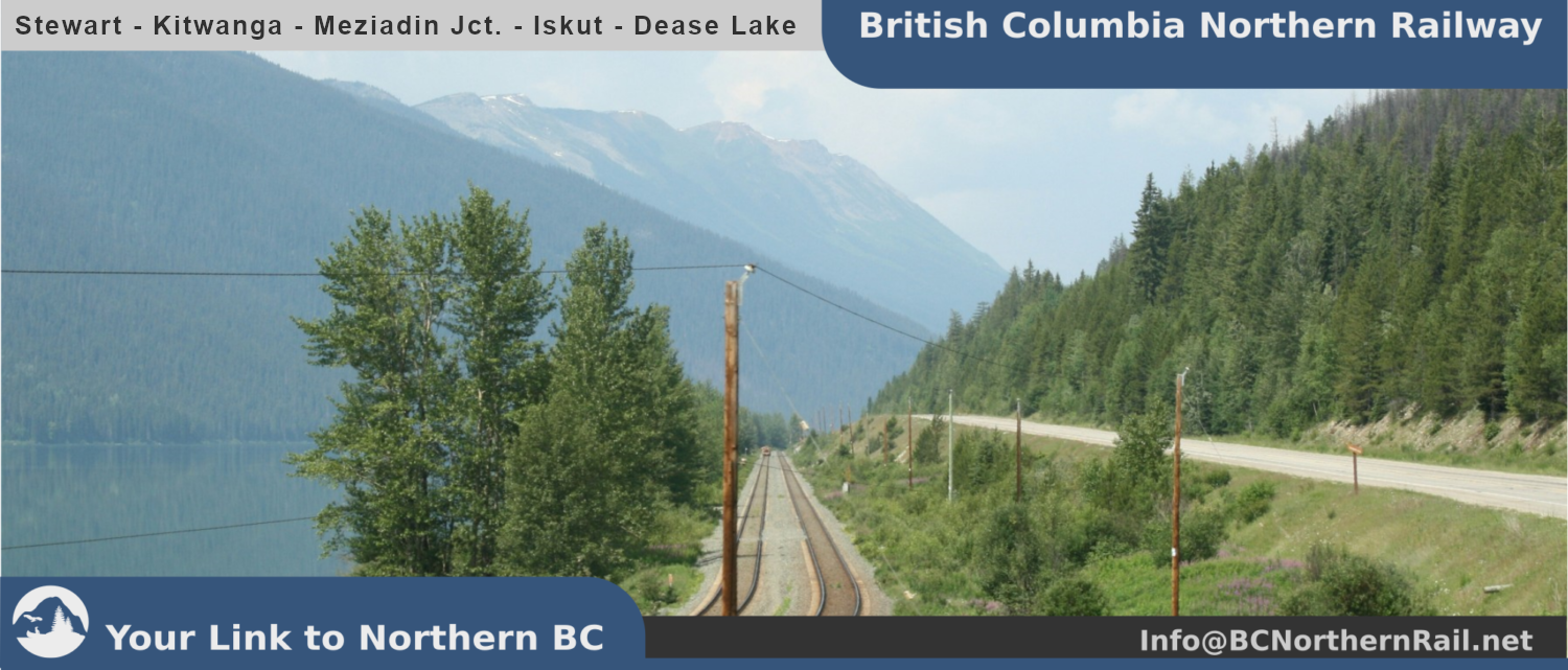
The proposed and projected Stewart Trunk Railroad (PDF-Document, external), which is also referenced as Canada Stewart Port Railway and Canadian Stewart Railway on the website of the Stewart World Port, which happens to be the BC Northern Stewart and Kitwanga Subdivisions of my model railroad (both parts of the BC Northern Skeena Division, which additionally includes the Nass River Subdivision and the Alice Arm Branch Line).
So, as there already is a proposed railline, whose right of way has already been surveyed (on a preliminary basis), I have a very solid foundation for my railway planing (I apologize for intermixing the terms „railroad“ and „railway“ from time to time. I grew up with model „railroading“ and have switched to use the canadian term „railway“ more often since designing the BC Northern Railway, but habits tend to stick well). On the PDF-Map (linked above), near KM 200 there is a narrow gorge with barely enough width to accomodate the road (Highway 37A) and most certainly not the railroad next to it (witchout blasing away more of the rockface). Feel free to use the embedded Google StreetView feature to explore.
It’s a beautiful scenery and I can imagine either the tracks embedded in the streets or the contruction of a short tunnel or arcade/rockshed like structure parallel to the road which also could be used by on lane of the Highway, while the other remains at its current location (where the lane near the river might be utilized as a rest area). Well, my shelf layout won’t offer too fancy options here, so I’ll experiment a bit.
With the projected Railway referenced above goind alongside Clements Lake – where a recreation site is located – the peacefulness of the lake and valley would vanish with the railroad goint through there. Maybe only twice a day in each direction (as mentinoned in the background story), but potentially increasingly more for better utilization of the line.
So relocation of the recreation site would be necessary or running the tracks through an 855m long tunnel beneath the camp site (too expensive), which both wont seem to be amicable. Continuing following the Glacier Hwy. further west would also require a 545m curved tunnel or crossing the highway multiple times in a short distance. Also not very amicable and still very expensive. So we’re gonna be blasting away rock faces again, I guess, or just go through the recreation site.